
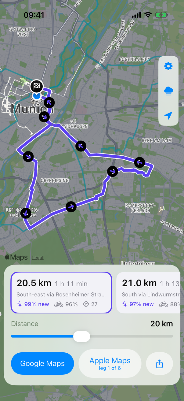
A 20 km loop from central Munich. Purple is road still under fog; the white tracks are places already visited.
The fog layer is drawn straight from Fog of World's own data.
Several loops are offered each time, so you can pick a direction.
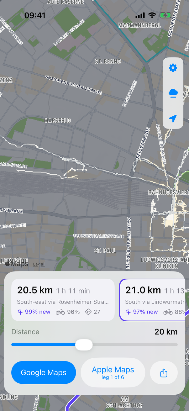
The fog layer, drawn from Fog of World's own data.
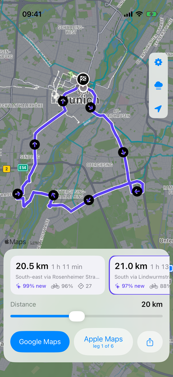
Several loops are offered each time.
What it does
Finds the fog
Every road nearby is checked against your Fog of World map. Loops are steered toward the neighborhoods with the most road you haven't ridden.
Brings you back
Each route is a loop that ends where it starts. A slider sets the distance, from 5 to 40 km, and the loops update as you drag.
Rides well
Routes prefer bike lanes and paths, keep turns down, and avoid riding the same stretch twice.
Tells you the cost
Each loop shows its length, an estimated riding time, how much of it is new, how much is on bike infrastructure, and how many turns it has.
Hands off to navigation
Send the loop to Google Maps as via-points, step through it leg by leg in Apple Maps, or export a GPX track for Komoot, Ride with GPS and others.
Stays on your phone
Planning runs on the device. Your Fog of World data is only read, never changed and never uploaded.
How routes are chosen
Roads come from OpenStreetMap. Each road segment is mapped onto cells of about 23 m, and a cell counts as seen if any part of it is uncovered in Fog of World. A loop gets credit for each fogged cell once, so the two sides of a divided road don't count as new twice.
Candidate loops are built by placing a few waypoints around a circle through your start, pulled toward the foggiest areas, and joining them with paths that are cheap on fogged, bike-friendly roads and expensive on visited roads, busy roads, turns and repeats. The circle is resized until the loop matches the distance you asked for. The best few loops that differ from each other are shown.
How to install
FogRide is not on the App Store. You build it yourself with Xcode, which is free, and run it on your own iPhone.
- Download the source from GitHub and open
FogRide.xcodeprojin Xcode. - Select the FogRide target, open Signing & Capabilities, and choose your team.
- Plug in your iPhone, choose it as the run destination, and press Run.
- In the app, tap Choose Sync Folder and pick the
Syncfolder that Fog of World keeps in iCloud Drive or Dropbox.
The first time you use it in a new area, the app downloads the local road network, which takes about a minute. After that it plans in under a second.
Good to know
Google Maps and Apple Maps only accept a list of stops, and each routes between them in its own way, so what they navigate can differ from the line FogRide drew. The GPX export is the only exact handoff.
FogRide is an independent hobby project. It is not affiliated with or endorsed by Fog of World or its maker, Ollix. It reads the sync files Fog of World stores in your own cloud folder; you need Fog of World, with sync turned on, for it to be useful.